The image below shows an area of the lava flow with Sunset Crater in the background. Visitors are no longer able to walk to the top of the crater as erosion has, in the past, caused damage to the tree system on the south side of the crater. One of the wayside markers mentioned that during the 1930s a movie was being shot outside of Flagstaff and the climactic scene called for Sunset Crater to blow up. Something the director of the film actually wanted to pay the townspeople for the right to do; thankfully they rejected his offer and the movie was forced to shoot their climactic scene elsewhere.
 This next picture shows one of the collapsed lava tubes in the Bonita Flow area. As the lava flowed down from Sunset Crater, a crust began to form, eventually it hardened to a thickness of several feet. When lava no longer flowed beneath the crust, earthquakes occurred and most of the lava tubes collapsed in on themselves. Rachel and I saw these collapsed tubes all over the park.
 This final photo from Sunset Crater shows the crater and another part of the flow. There were many amazing things to see at this site. The wayside markers were very good as far as NPS sites go. On the side of the crater you can see a dark area where very few trees grow today as well as a few lines, faint but just visible if you study the picture. This is the area that tourists used to use as they climbed the crater. The devastation caused by the thousands of tourists over many decades has resulted in the loss of many trees as their root systems (already tenuous) became increasingly exposed as more and more people walked over them on this part of the crater.
 Sunset Crater was fun to explore and very educational as well. Once we left the park, Rachel and I had learned that we had moved to a volcano field, volcanic highlands, a region of over 600 volcanoes! I was never bothered living close to the Yellowstone caldera, we were told that if that caldera blew its top, there would be no point in trying to flee the Little Big Horn National Monument. However, this does bother me slightly, for one major reason.
Geologists used to think that Sunset Crater was hundreds of thousands if not millions of years old. In fact, it wasn't until they discovered pit dwellings and pueblos beneath some of the lava flows that they realized humans had lived in this area before Sunset Crater existed and had to flee the area. All of the wayside markers discuss the fact that there is still activity beneath this lava field and at some point, most of the geologists agree, another volcano will form close to the east of Sunset Crater. It is a little scary but also fascinating to think about that type of cataclysmic change happening in this area.
On Sunday Rachel and I wanted to take another trail and see more of Flagstaff. We decided to take Sunset Trail to the top of Mount Elden. This trail was rated as easy.....EASY.....hmmm. We discovered that the rating should have been moderate to strenuous once we began hiking. Here are some of the beautiful pictures we took today on this trail:
The first one is of Rachel in an Alpine Meadow on one of the many switchbacks on the way to the summit.
 Along the trail we saw three boulders that were broken in two with small trees growing
through the fissure.
 There were many interesting trees along the trail other than the ones that were breaking boulders as they grew. We saw evidence of recent controlled burns that left tall, charred tree remains everywhere. We also witnessed graffiti carved onto birch trees. Some of this graffiti was several decades old.
And everywhere we went, Humphrey's Peak dominated the skyline. As this region of Northern Arizona is still considered to be a hot bed of volcanic activity, I should mention that Humphrey's Peak in the San Francisco Peaks range was at one time part of an even bigger mountain. In fact at one time all of the San Francisco Peaks were one large volcano, more than 16,000 feet high. When this volcano blew its top, the surrounding region and its vegetation were forever changed. As more volcanoes formed and erupted over the years, the climate of the region continued to change. Today it is possible to hike into the caldera of that old volcano, in the very center of the San Francisco Peaks range.

Here are the San Francisco Peaks:
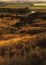
This picture was taken last week as we drove to Flagstaff on I-40.

The house we moved into is very beautiful and inexpensive for the neighborhood. Here are some photos of the house. We just had the couch delivered yesterday.
This is a view of the office with my desk. Rachel is hiding behind the door working on a blog.
 This is the couch that we bought Thursday at the Furniture Barn in downtown Flagstaff. There was a giant cow painted on the barn, Rachel saw that as a sign so we went in looking for a good deal and were lucky enough to find one.
 This is a picture of Rachel and our landlord, Fred. He is a real stickler for paying the rent on time and just to keep us on our toes, he will occasionally bite us on the ass. He really is sweet to do that for me.
And lastly, this is the kitchen table and chair set that we found at a thrift store on sale for $100. A very good deal since it is so beautiful and it has a nice design of wood blocks set into the top of the table.