Having read Colin G. Calloway's One Vast Winter Count last year at this time, it was with a great deal of excitement that Rachel and I hopped into the trusty Ford Taurus and headed north out of Flagstaff on U.S. 89 to Wupatki National Monument. Calloway discussed pueblo communities extensively in his book, but to see a pueblo in person and to walk around them is an amazing experience.
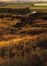
We drove through Sunset Crater National Monument on our way to Wupatki, and as we did so, we began to notice the temperature rise. We were leaving our beautiful little slice of heaven for the afternoon, and reentering the heat of the real southwest, which of course is easy to forget when you live in Flagstaff. Living at the base of a dormant volcano at an elevation of over 7000 feet has some advantages. The image above is one of the first shots we took at Wupatki, which has been protected by the National Park Service since 1926. Wupatki Pueblo is actually just one of many (and I mean many) abandoned pueblo sites protected in this national park. Others include Wukoki Pueblo, Lomaki Pueblo, the Citadel, Nalakihu Pueblo and of course my favorite, Box Canyon Pueblo. These are the only pueblos that are open to public viewing, some of them have been excavated by archaeologists and have been restored to some degree. the Citadel has not been excavated or restored. Here is a picture of what that structure looks like.
 The Citadel is pretty much in ruins right now. Excavations have been halted either for a lack of money or due to protests from local Indian groups. Here are some pictures of what the center of the Citadel looks like today.
 As you can see from this image and the one above. The walls of the Citadel have collapsed from a lack of maintenance. The mortar in the walls long ago began to crumble. All around the base of this pueblo are large piles of stones, some still have ancient traces of mortar on them.
According to the markers at each of the pueblo sites we visited, almost all of the pueblos in this region were built between 1050 and 1100 A.D. Most of the pueblos were abandoned within 150 years of their initial construction, again according to park literature. This seems like an awful lot of work for a group of people to go through just to abandon the buildings after three generations. According to archaeologists, the major reason that people evacuated these pueblos has to do with the lack of rainfall and changing environmental conditions.
From the top of the Citadel, these are some of the views you can see:
 The Citadel was actually built on top of a mesa that is covered with large black basalt boulders. The original builders of the pueblo used the boulders as part of the base of their dwelling, which can still be seen in some parts. This is a photo from the top of the Citadel looking off to the Northwest.
This is a picture from the top of the Citadel looking off towards the Northeast. In the far distance is the Painted Desert region of Arizona.
The photograph below provides an example of how the pueblo builders used the boulders on top of the mesa and built right on top of them. This structure was originally much taller, about three stories tall in some places. Today the wall only extends up about one floor in some places.
 Looking to the South from the top of the Citadel, one can see a large canyon that was believed to be a quarry source for pueblo builders in this region. This picture really does not do the canyon justice.
 Altogether we visited five pueblo sites, here are some of my favorite pictures of them:
This is another image of Wupatki from the canyon wall above the location where most of the stone was quarried for the pueblo buildings. Archaeologists estimate that at the Wupatki Pueblo as many as 100 family members might have lived together. On the hills and mesas around Wupatki it is possible to see other pueblos; however most of them are off limits to visitors.

The square structure in this picture was the source of a lot of fun for Rachel and myself. This is a blow hole. Something I have never heard of before. Basically it is a crevice in the earth's crust that blows air out (cool air) when the temperature is hot at ground level. This blow hole is relatively unexplored. Scientists do not know how deep the earth is cracked beneath the hole; it could be ten feet deep or one thousand deep. All we know is that once you go up to this hole (the square protects people from falling into the hole) you can feel a large amount of air being pushed out.
Rachel is demonstrating just how forceful the blow hole can be. When I took this picture her hair was blowing wildly around. I don't know if the picture does the hole justice. You'll just have to come to Flagstaff for yourself to see how much it blows.
 This next image is a picture of the ball court at Wupatki. When archaeologists discovered a ball court (a Mayan influence) this far north, it helped them understand that civilizations from this region had extensive networks of trade, dissemination of culture, etc. One of the shared cultural experiences that probably helped facilitate interaction between different tribes was sports competition. A ball court would also have brought visitors from nearby pueblos to Wupatki for trade and interaction.
This image is meant to show the dimensions of the court. We were actually allowed to walk all around this pueblo site and the ball court which helped us understand a lot more about the size of the buildings and their construction.


The pueblo you see on the right is at Box Canyon. A series of small dwellings was constructed along the rim of Box Canyon. This dwelling has two medium size rooms that you can observe by following a trail up the pueblo. Or you can visit the other Box Canyon pueblo at this site.

This is the second of the two Box Canyon pueblos. It is a slightly more substantial structure, but still quite small compared to other pueblos at this national park site.
I took a picture of one of the wayside markers and have put it on this blog along with actual pictures of the geographic features the marker mentions. If you click on the picture below you can read the marker better. I have labeled each of the geographic features below in order of how they appear listed on the marker.

This is East Mesa.

Sunset Crater

The Citadel Ruin can be seen at the center of this photograph. It is easier to see if you click on the photo, a blow up image will appear.

This is O'Leary Peak
 Middle Mesa
 The San Francisco Peaks (Where Flagstaff is located).
Box Canyon Ruins (Again, it might be easier to see this if you click the photo)

The Volcanic Cinder Cone Fields


Our final pueblo visit was to Lomaki Pueblo. This was a beautiful site. The pueblo had about 15 rooms to explore and at one time it had many more than that. Lomaki, like Box Canyon, was built on the edge of a canyon. This is a picture from the north end of Lomaki Pueblo.
 Another view of Lomaki Pueblo.
A view from one of the largest pueblo rooms we were allowed into at Wupatki National Monument.


As we finished exploring Lomaki Pueblo I snapped this picture of the sunset. This was a very good day, the only complaint I have is that I had to go home and read all night, although that is the major reason why I left Toledo. NAU pushes its students to work hard, which is necessary for someone like myself who is not always the best self-starter.