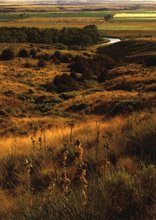
By nightfall we made it to Page and spent the night in a Days Inn...listening to the sounds of the movie, Borat, coming from the next room. The next morning we were in for a great surprise, the beauty of the surrounding region. We did a little exploring and discovered that Page has existed for a little under fifty years. The town is actually located on Manson Mesa, about 17 square miles, which was secured from the Navajo in a land exchange. The original inhabitants were employed by the United States Bureau of Reclamation in the construction of the Glen Canyon Dam, which was finished in 1966. Glen Canyon Dam is a major source of water and energy for the Southwest, making the growth of the region during the second half of the twentieth century possible. One of the other major sources of energy for the Southwest is the Navajo Generating Station. The NGS is visible from many miles away (we were still able to see it as we drove in southern Utah). The three smoke stacks of the plant are each about 708 feet tall, making them tallest structures in Arizona.
 After a quick breakfast, Rachel and I were off to explore Page. First we headed north of town to the Glen Canyon Dam for a tour. The guide was very informative and he explained the entire process of how the dam produces electricity and the way that each state in the Southwest receives their "legal share" of Lake Powell water every year. Currently the region is suffering from a drought and the lake is down 108 feet. Here are some pictures of the dam and bridge structure.
 Here is a picture of a slab of rock outside the Glen Canyon Dam visitor center. This rock slab clearly shows dinosaur tracks.
 Here is another shot of the bridge. The bridge sits approximately 580 feet above the Colorado River.
 The next two pictures show views of Lake Powell, behind Glen Canyon Dam and the Colorado River, the area in front of the dam.
 The Colorado River as it leaves Glen Canyon Dam:
 And yet another view of the Colorado River. (I should let everyone know right now that this is going to be a picture heavy blog. We took about 150 or so pictures any they all came out quite nicely.)
 After arriving at Glen Canyon, as mentioned, we were given a tour of the facility. Since 9/11 the dam has had a pretty high level of security. On the tour we were given, a security officer followed our group of about 10 people throughout the complex. Never close enough to speak to her, but always close enough to know that every move was being monitored.
The tour started by leaving the visitor center and taking an elevator down to the top of the dam. We were allowed to go out on the dam and take pictures for awhile before we got into an elevator that took us down 700 feet or so to the dam's generator room.
Here is one of the pictures I took looking down from the top of the dam. The service vehicles you see in this picture drive to the bottom of the dam through tunnels carved out of the rock cliffs. If you look closely you can see the tunnel.
 After the elevator ride to the bottom of the dam, we were led through a series of bright hallways and out into a very large open area, located between the dam and the generator room, known as the yard.
 The squares in this picture conceal stairwells to the service tunnels for each of the twelve pipes that feed the generators.
This is a picture of the dam from below. Our tour guide pointed out the large strip of moss stretching out from the mid point of the dam along the cliff walls. The reason the moss grows at this location, he said, is because of the water that leaks around the edge of the dam wall. That is a comforting thought...the dam has a leak!
 The generator room:
 Visiting Glen Canyon Dam was a pretty enlightening experience, especially the information I acquired about water and electricity and how it has transformed the American Southwest.
After we made our purchases in the bookstore (Rachel bought another pin to add to her National Park collection, I bought a book on Rainbow Bridge), we stopped for lunch and planned out the rest of our day.
We both enjoy National Parks that focus on nature so we decided to head north, following U.S. 89 toward Grand Staircase-Escalante National Monument. As we crossed over the state line into Utah I noticed a scenic lookout marker. From this marker we were able to see all of the surrounding region. The Vermillion Cliffs, Lake Powell, the Navajo Generating Station, and various other features.
Here is one of the coolest things that we saw (and yes, Mike, I took this photo just for you; it gives you a taste of what is coming in March). Navajo Mountain:
 In March we will walk to Rainbow Bridge National Monument and the trail will take us along the western base of this mountain.
Here is a picture of the Navajo Generating Station from about 30-40 miles away. Imagine being able to see from Marion to Upper Sandusky and then on to Carey as well. That is about how far a person can see in certain parts of the West.
 A picture of our new car, which performed like a champ on this trip:
 Here are the pictures we took at Grand Staircase-Escalante. On display was a small collection of dinosaur fossils that were discovered at the park.
This is part of a foot:
 And this is a large section of a dinosaur tail:
 Grand Staircase-Escalante definitely has a lot for visitors to explore. We didn't even scratch the surface in our short visit.
 We next made our way to Zion National Park. Here are some of the pictures:
 We drove through a mile long tunnel carved through a mountain to get from one side of the park to the other. On occasion, there were openings like this one which enabled us to see hundreds of feet below and across from one mountain to another:
 When we exited the tunnel, we began to make our way down a series of switchbacks. At one point we looked up to the side of the mountain we had just exited and we could see this window from below (its big enough for a tour bus to fit in longways):
 Some more spectacular views:
 A natural amphitheater:
 View from the Zion campground:
 After we left Zion we made our way west to Interstate 15. We spent the night in a terrible Best Western before heading back to Arizona on Sunday.
On Sunday we made our way to St. George, Utah and then over to Hurricane, Utah. To leave Hurricane, we had to drive up a 400 foot tall cliff. Mormons used to bring cheese, cream, and butter from our next destination DOWN this cliff, a very hazardous job at the time. The food went to the workers who were constructing the LDS temple in St. George at the time.
Our final National Park of this trip was Pipe Spring National Monument in the Arizona Strip. If any of you ever get the chance to drive across this part of Arizona it is well worth the time.
Here are some photos of the region:
 Another:
And another image of the strip:
 And a final image of the strip:
 As mentioned, we visited Pipe Spring National Monument before heading home to Flagstaff Sunday night. Pipe Spring preserves the cultural history of Native Americans and the Mormons that made the Arizona strip their home and one of the few sources of water that can be found in this area. Before the arrival of white settlers, Native Americans like the Paiute and Anasazi adapted the water to their subsistence economy. When the Mormons arrived in the area, they built a fort around the water supply and prevented the Native American tribes from using the water. This caused the Kaibab band of the Paiute tribe to starve and by the end of the 19th century, only about 75 were still alive.
Here are some pictures from this National Park:
This is the spring that was stolen from the local tribes.
 This is a trunk with the painting of a person's homeland on the inside lid. Often immigrants would have scenes of what they were leaving behind painted on their trunks since they did not yet have photographs.
 The outside of the fort:
 One of the reservoir pools used for the vineyards, orchards, and livestock.
 Another angle of the trees around the two reservoir pools and the fort.
 This was an amazing trip, but I am glad to be back now. The semester has just started and I already have lots to keep me busy. I look forward to seeing other National Parks in the Grand Circle, especially Arches National Park and Bryce Canyon.